How “Internet in Space” Will Transform the Satellite Imagery Industry: Part II
(Second, Some Predictions)
Disclaimer: I work at Umbra, a satellite imagery provider with various entanglements and alliances that probably influence my views on this topic. However, I don’t speak for Umbra. I used a large language model (LLM) artificial intelligence to write any and all sections you find tedious or unfunny. All the good parts I wrote myself.
Welcome to Part II of this riveting series about the impact that “internet in space” will have on the commercial satellite imagery ecosystem. Unfortunately, what I thought was going to only take two installments has now ballooned into three...as the saying goes, I would have made it shorter if I’d only had more time.
If you missed Part I, count yourself lucky. For those of you who feel like punishing yourself, be my guest:
This is all the rehashing I’m gonna do on Part I: dozens of companies, including some of the biggest ones in the world, are building “relay” constellations that will enable realtime two-way communication with Earth observation satellites in just the next few years (demonstrations have been made, launches are planned, knives are being sharpened).
I’m not going to speculate on which of the many competitors entering the relay race are going to be successful.1 But I’m gonna assume at least a couple of them will be.
And when they are, I have three major predictions about what will happen:
There will be sweeping ground station provider consolidation by the cloud providers.
The concept of “direct tactical downlink” will go extinct.
Demand for edge processing in space will plummet to near-zero (with a notable exception).
The first and second of those will be covered in this installment; the third will be covered in Part III.
Death of a Ground Station Salesman
Back in my day, you used to have to sit around and wait for satellites to make contact with a ground station before you could give them new commands or get data and telemetry back.
But pretty soon, you won’t have to wait. Relay constellations with radios for commanding and high-throughput laser links for backhaul will soon dot the sky and enable information to travel from the ground to the satellite and back at close to the speed of light.
I always look to Uber and Lyft for how the satellite imagery industry should work. Think about it - the user experience of tasking a satellite to point at a place on Earth should be exactly like calling an Uber.
And if you look at how the ride sharing business has evolved, they will charge you less if you are willing to wait longer for your ride to show up. That’s how “rush delivery” of satellite imagery via relay will likely play out to start. Pay a little less, get your data down a little slower.
Instantaneous commanding, on the other hand, probably won't cost extra, since the data rates are so much lower and can be done via old school RF.2
My guess—and it truly is just a guess at this point—is that the relay constellations are all aiming to be cost-competitive with traditional ground station providers. I don’t think they have to be 1:1 to justify switching whole-hog, but parity makes the siren song irresistible.
All that spells trouble for the legacy ground station providers.
Why would you ever wait to downlink directly to a ground station if you could instantaneously relay it to the cloud? It would be like selecting the 15-minute-delayed Lyft driver when another one two minutes away cost the same.
But it’s even a little worse because of the complexity satellite imagery providers have to keep track of today with ground stations and “passes” over them—why should I have to understand the plumbing used to get my data down at that level of granularity?
I shouldn’t. My data should just appear in my blob storage in the same cloud environment and region I do everything else in. I don’t care the path it takes to get there as long as it’s fast, legal, auditable, and secure. Which is pretty much the same set of objections cloud providers have been working tirelessly to have unassailable answers to for the last decade.
Ok, so if can relay data to and from any compatible dish or ground station in the world, more or less instantly, what does that imply about how ground infrastructure might change?
Well, for one, you don’t need spatially proliferated data centers if you don’t need direct line of site. You may want regional stations to make backhaul over the open internet to certain geographies faster by strategically placing them near important nodes (much like the cloud providers have major hubs all over the world). Someone smarter than me can build the spreadsheet running the math on cost vs benefit for that one…
If you read Part I of this series, you know that ground station site selection is a huge deal, and there are very large international businesses predicated on superior positioning of ground stations for reliable line of sight to common inclinations, like polar orbiting low Earth orbit Earth observation satellites.3
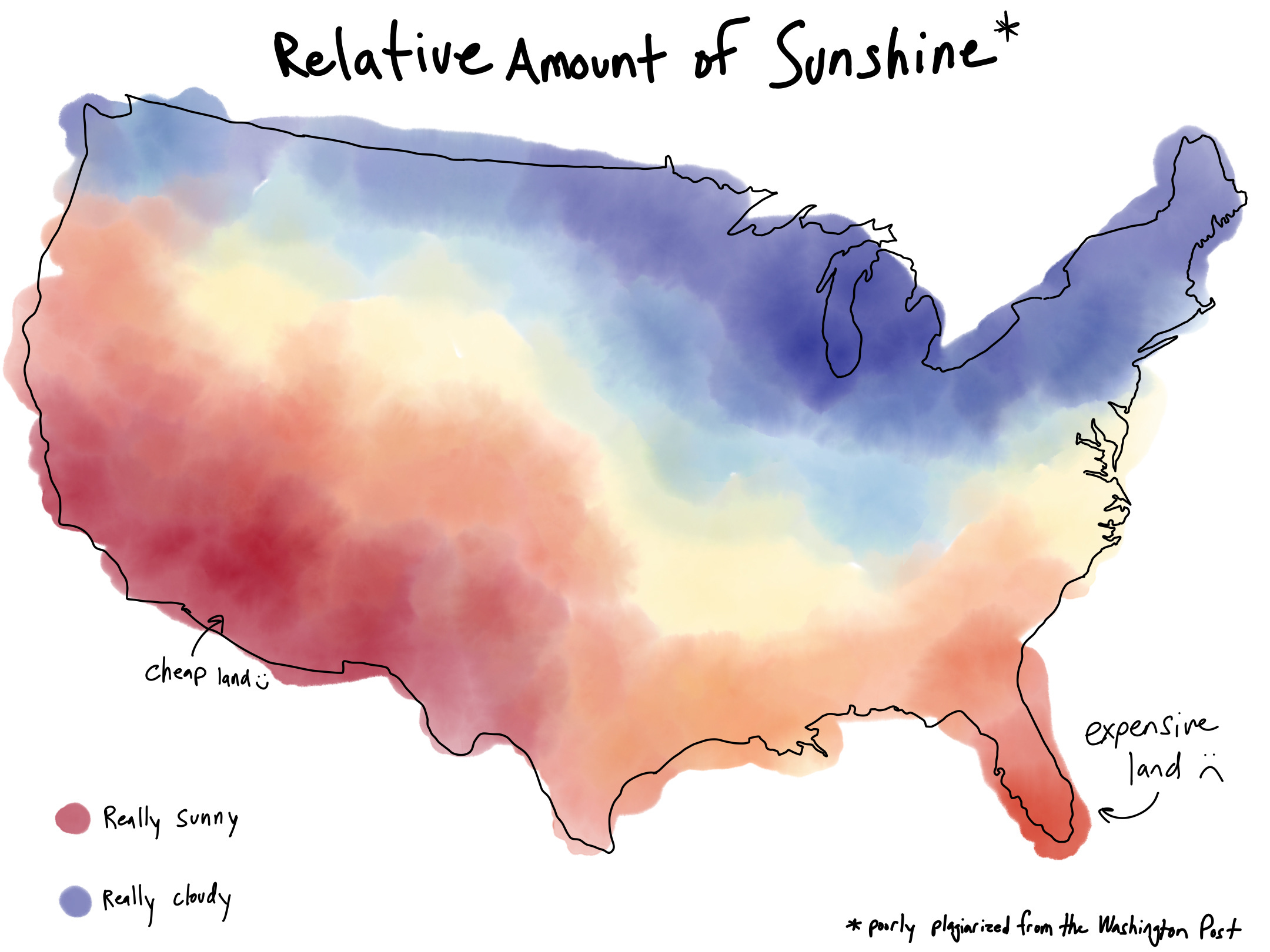
But, if I were getting into the ground station game now, I wouldn’t be packing my extra-warm coat for the tundra-covered stomping grounds of the old guard. I’d be picking out my favorite Hawaiian shirt to go searching for the sunniest stretch of gigabit-speed fiber backbone I could find.
Because the new name of the game is: lasers. Space lasers, to be precise.4


These are the primary tools of relaying mass-quantities of data around the globe. If you think deeply about how a relay constellation works, it starts to hurt your head—these things autonomously spin on gimbals, locate their nearest neighbor, and pulse information across the fabric of spacetime at gigabit speed…
These relay constellations will also use regular old radios to communicate with each other and share smaller data packages (eg commands, telemetry, software updates etc.).
It’s like having a virtual ground station in space, distributed across LEO in thousands of nodes all whipping across the sky at many times the speed of sound.
And they can either send data back down to Earth via radio (low bandwidth, but not generally affected by weather) or laser link (high bandwidth but foiled by clouds).
Now, if you have 3,000+ satellites in your relay constellation, one of them is gonna have a bead on just about everywhere on Earth at all times. And that means wherever the relay constellations choose to put their ground stations, they should always be (indirectly) capable of contacting every satellite compatible with their network as long as they have line of sight to a relay satellite (which, they always should).
So where would I, Joe Morrison, locate my fields of radar antennas? Thanks for asking.5

Vivaaaaa Las Vegas! I’d look for extremely sunny areas near major fiber nodes on the cheapest land I could find. The suburbs of Las Vegas, Phoenix, and Albuquerque top my list for North America.
You could run this same analysis for anywhere in the world. Here’s a good starting point: https://globalsolaratlas.info/map.
Storm Clouds on the Horizon
So far, two of the three major cloud providers have decided to make a run at the ground station establishment: Amazon’s AWS Ground Station and Microsoft’s Azure Orbital Ground Station. Google appears to be partnering with SpaceX on their ground infrastructure, but hasn’t announced a one-size-fits-all service (at least, not yet).
In the words of the indisputable conscious of my generation, Cardi B, the cloud providers are making “money moves.”
Over the coming few years, will these behemoths gobble up the many dozens of independent ground station providers around the world? Probably a few of them. I think most others will die of natural causes in short order.
There will always be a small number of "indy" ground stations that hold out, but I think that will be primarily for uneconomic reasons. Most likely they'll operate systems used specifically for government work that comes with its own set of idiosyncratic political, regulatory, and procedural pressures. It’s not too different from how there will always be national constellations for both comms and Earth observation despite buying commercially almost always penciling as a much better deal.6
Take this all with a grain of salt - people have been making the same (bad) call for a lot longer than I’ve been alive. One of my favorite accounts on Twitter, a small ground station provider in Dundee, Scotland, put me on blast for this prediction. “Rumors of my death have been greatly exaggerated,” as they say.

And the most obvious objection to this newfangled common pipeline for tasking satellites is The One Major Concern…some of you spooky types have been thinking it this whole time…
“Wait!” I hear you calling from behind the dim glow of your phone as you read this incredulously on the toilet, “Won’t it always be more secure to directly downlink to a trusted ground station and therefore there will always be a role for geographically distributed and even mobile ground stations, especially for military users?”
Great question, imaginary interlocutor. And incredibly convenient, as well. Because I’m gonna talk all about that in the next section!
Tactical Impractical Downlink
The concept of “tactical” or “in-theater” downlink is very simple: rather than route tasks and data through a standard ground station network, out to the open internet, and then onwards to end-users, you simply instruct satellites to downlink certain data “directly” to those end users who receive and process the data locally.
The two most common places this pops up in the industry are:
“Direct access” programs that allow customers to task satellites and receive data directly during reserved orbits or sections of orbits without the commercial provider knowing much about it at all.
“Mobile ground stations” that enable military units to receive data in the field and process it locally where it can be put to use immediately.
Most people have never heard of either, because most people aren’t a top-50 military in the world. Direct access, in particular, is a tried-and-true business model - it’s Maxar’s bread-and-butter, and they oughta know what works, because they’re currently being acquired for a whopping $6.4B.
And tactical downlink is emerging as a topic du jour in military circles where fears of a potential “denied” or “degraded” space environment in the event of a major conflict have prompted people to think about creating more resilient protocols and systems.
In both of these cases, the rationale for all the added complexity is that it’s more secure to directly interact with the satellites than it is through a third party network. Military and intelligence customers care a lot about what’s called “chain of custody,” and ensuring that prying eyes didn’t see what they collected or, worse, intercept and sabotage the data in some clever way.
However, my contention is that modern hashing, authentication, and end-to-end encryption techniques allow for information to flow very securely across the open web. And no, I’m not talking about blockchain, I’m talking about stuff like SHA-3, the Double Ratchet Algorithm and open implementations of authentication schemes like JSON Web Tokens. These are all open standards with ecosystems of paid services built around them for ease of access - there's no need to reinvent the wheel.
Now…even if the data is encrypted at rest, there’s still a trust issue. You might actually want your imagery provider to do quality assurance on the data before sending it to you. You might also want them looking at things like telemetry to help ensure continuity of service and health of the satellites.
But, whether you’re dealing with a direct downlink or a relay through an open network, that element of trust will always be required. My basic point is that, with proper authentication, end-to-end encryption, hashing/provenance services, and other independently audited security measures, the level of trust is really no more elevated for tasking over the open internet than it is for direct access or tactical downlink.
We’re seeing in real time how Starlink is making a huge difference in Ukraine where the importance of maintaining comms is paramount and commercial satellite imagery providers are moving the needle. Ukraine didn’t need to invest $100Ms in mobile ground station infrastructure to be able to take advantage of that - and it can certainly be done securely based on mutual willingness to authenticate, encrypt, and hash data going back-and-forth across the wire (all with free and open technology).
And even in a degraded or denied space environment where jamming and even Anti-satellite weapons (ASAT) have been deployed, you have to think to yourself…will it be easier to establish contact with 3,000+ node comms network or a 30+ satellite imagery constellation…not to mention which of those two is more likely to be rapidly redeployed (the one with manufacturing capability to churn out 1,000s of satellites in short order and multi-purpose uses beyond just ISR).
I concede a few things:
I am not a cyber security expert by any stretch of the imagination, nor do I hold a clearance, so I don’t know if there are other reasons why direct and tactical downlink may be necessary (even, perhaps, for logistical reasons e.g. physical proximity to air-gapped environments).
Changing the hearts and minds of the world’s military and intelligence leaders happens over decades, not months, and there’s a clear emphasis on direct and tactical downlink across the world that won’t reverse course overnight.
So, while I’m skeptical of the longterm utility of this kind of technology, I think every satellite imagery provider needs to create some offering in this regard to stay competitive. I don’t begrudge them the choice, nor do I envy the effort required to duplicate most of your ground segment for on-premise deployment.
More to come…
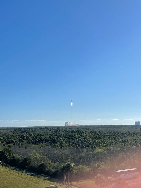
Part III will be all about processing at the edge in space - I had intended to include it in this blog, but Part II was already way too long. Plus, I’m back to work this week, and we just launched two more satellites today, so things are…busy.


First of all, oh my God, how long has Substack had footnotes built in?? And I’ve been making them manually??? 🤦♂️
Second of all, can we just take a moment to appreciate “relay race?” I mean, that is really. good.
I’m kind of obsessed with surge pricing. I’m not the first person to think of this, even at my own company, but if capacity over a small area of high demand is tapped, shouldn’t the price float until an equilibrium is reached? And likewise, if you’re in the middle of an empty orbit over the arctic, shouldn’t a researcher get a look at their favorite calving iceberg for next-to-nothing (after all, even just making $10 on that image is better than making nothing).
But the thing I always get stuck on is the reason for surge pricing being such an important feature for Uber/Lyft and how it doesn’t analogize to satellite imagery constellations. They’re trying to entice more drivers to get on the road. Customers hate surge pricing. But they live with it, because it’s usually short-lived and overall the companies can almost certainly demonstrate, statistically, that it creates a better value for customers on average by alleviating undersupply when demand spikes.
Surge pricing for satellite imagery should result in increased supply, but the time scales are a little off…the additional margin from surge pricing would likely be converted into additional supply in the form of more satellites sooner, but that wouldn’t materialize for years, which would not be much consolation to a customer ordering an image in an emergency situation.
Try saying this phrase three times fast out loud “polar orbiting low Earth orbit Earth observation satellites.”
I can’t do it. I tried for a few minutes, which if you give it a shot you will find is way too long a time to keep trying it.
If you can actually do it, record it, and I will embed it in my next newsletter. It’s gotta be fast and clean, though.
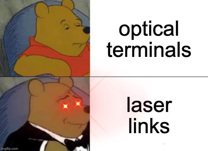
I love how terrible we are at naming things in this industry. Depending on who you ask, these “laser links” are often referred to as “optical terminals,” and I’m sure there are even more specific (and accurate) ways to describe and classify them. Talking constantly about “optical” payloads on Earth observation satellites isn’t confusing at all, considering those satellites are most commonly optical telescopes…
The confusing jargon gets so much worse in this industry—people try to disambiguate different types of sensors by referring to the satellite payloads as electro-optical, commonly abbreviated as EO (vs. SAR, for isntance). Except that EO is also an extremely common abbreviation for Earth Observation.
Aravind said it best, as he usually does
Nobody asked.
I’ve heard this referred to in the industry as a “pride bird” or “pride constellation”.


Long time listener -- first time caller. Thanks Joe for your constructively provocative thought service. I certainly appreciate that moving mindsets (esp government) takes a very long time. Relative to this recent thread of yours, I’ve been advocating replacing the term “direct downlink” with “direct access” for a couple of reasons: 1) it is in fact what the user actually wants -- and 2) it avoids assigning the solution to the problem. I do agree that many in govt will want/need to add “assured” to that phrase (thus, “assured direct access”) -- but I’d argue that has been (and will be) a continuum. And, I’d humbly observe, that if a military unit in extremis needs the data to survive a real-time threat, they’ll take the access and worry about the assuredness later. Onward.
Aligns with what I'm seeing. Worse for those services, such as KSAT, is companies like Amazon and Microsoft are really beefing up their networks. Microsoft basically offers a cargo container it can put anywhere, hook it into fast networks, and away you go. It talked about that offering in a co-announcement with Gwynne Shotwell (in 2021, I think).
If there were one thing that truly concerned the military about using commercial networks, it's the possibility of latency. Now, I'd argue that a constellation like Starlink would help significantly against that, but the DoD is very conservative in its approach and I could see them using both, falling back to the legacy systems when something like Starlink boofs it.