TL;DR I’m starting a new job at a satellite startup this month. Think of this like a poor man’s “Why I left Google to Join Grab.”
After a little over five years, I’m leaving Azavea. Some day, I’ll write more about my experiences there. I loved every day at Azavea. Parting ways has been bittersweet, to say the least.
Alas, it’s time for a new adventure. Later this month, I’ll start a new position as Head of Product Success and Impact at Umbra, a satellite imagery startup.
I’ll talk a lot about Umbra later on in this post, but first, allow me a brief digression.
Why Commercial Earth Observation is Such a Dysfunctional Industry
I caught the writing “bug” earlier this year when I published a diatribe on the commercial satellite imagery industry, “The Commercial Satellite Imagery Business Model is Broken.”
In my job at Azavea, I bounced between the roles of customer, vendor, and partner to many of the major US- and EU-based Earth observation companies. More often than not, those experiences left me feeling disrespected and frustrated (even as someone who was actively working to help them sell more imagery).
As I wrote in the original post, the industry’s brokenness is the logical outcome of two complementary economic forces:
The historical capital requirements to build, launch, and run satellite constellations (and the subsequent governance structures that arise from aggressive fundraising)
The near-monopsony of the US DoD, and the stagnant handful of firms that have made up the large majority of the commercial market to date (i.e. Google Maps, Apple Maps, Bing Maps, etc.)
So, why dig myself deeper into an industry that has caused me so much heartache and that does not appear, to me, to be growing quickly?
Because we’ve only just crossed an inflection point in the cost to serve timely, high-fidelity satellite imagery that will dramatically expand the number of customers who can profitably incorporate information derived from satellite imagery into their decision making processes.
At least, I think.
Limitations of Optical Imagery
Even if the big players expressed a genuine interest in selling data into commercial markets, they probably couldn’t afford to, which is the central lament of my earlier piece on the subject. Speaking specifically about folks like Airbus, Maxar, BlackSky, and Planet, who mainly sell optical imagery, they’re up against some existential constraints.
Capacity
Optical imagery capacity is artificially limited by incessant cloud cover and available daylight hours—a great majority of the world is obscured at any given moment by one or both of those two confounding variables. The consequence is that much of the time that optical imagery satellites spend orbiting the Earth is a total waste.
Limited tasking capacity drives the price of imagery up—you may think you’re paying for imagery, but the satellite imagery providers are thinking in terms of time. The more average passes around Earth that are required to complete a single order, the fewer orders each satellite can process, and the more it must cost at a minimum for all orders.
The satellite imagery market today has settled into a lopsided economic equilibrium entirely concentrated in two buckets: customers that can reserve a lot of capacity upfront (e.g. the military) or customers that are extremely flexible about the timing of image captures (e.g. commercial customers building satellite imagery basemaps). All others need not apply.
Physics
The laws of physics are working against these optical imagery providers. Satellites orbit at a high altitude above Earth, even though they’re in what’s called “low Earth orbit.” These instruments tear across the sky at 15,000+ mph while suspended hundreds of miles above the Earth’s surface, and yet the pictures they take can resolve street markings and car windshields on the ground below.
The lenses that high resolution satellites use are enormous and so are their housings—WorldView-3, for instance, is over eighteen feet tall and clocks in at over three tons…
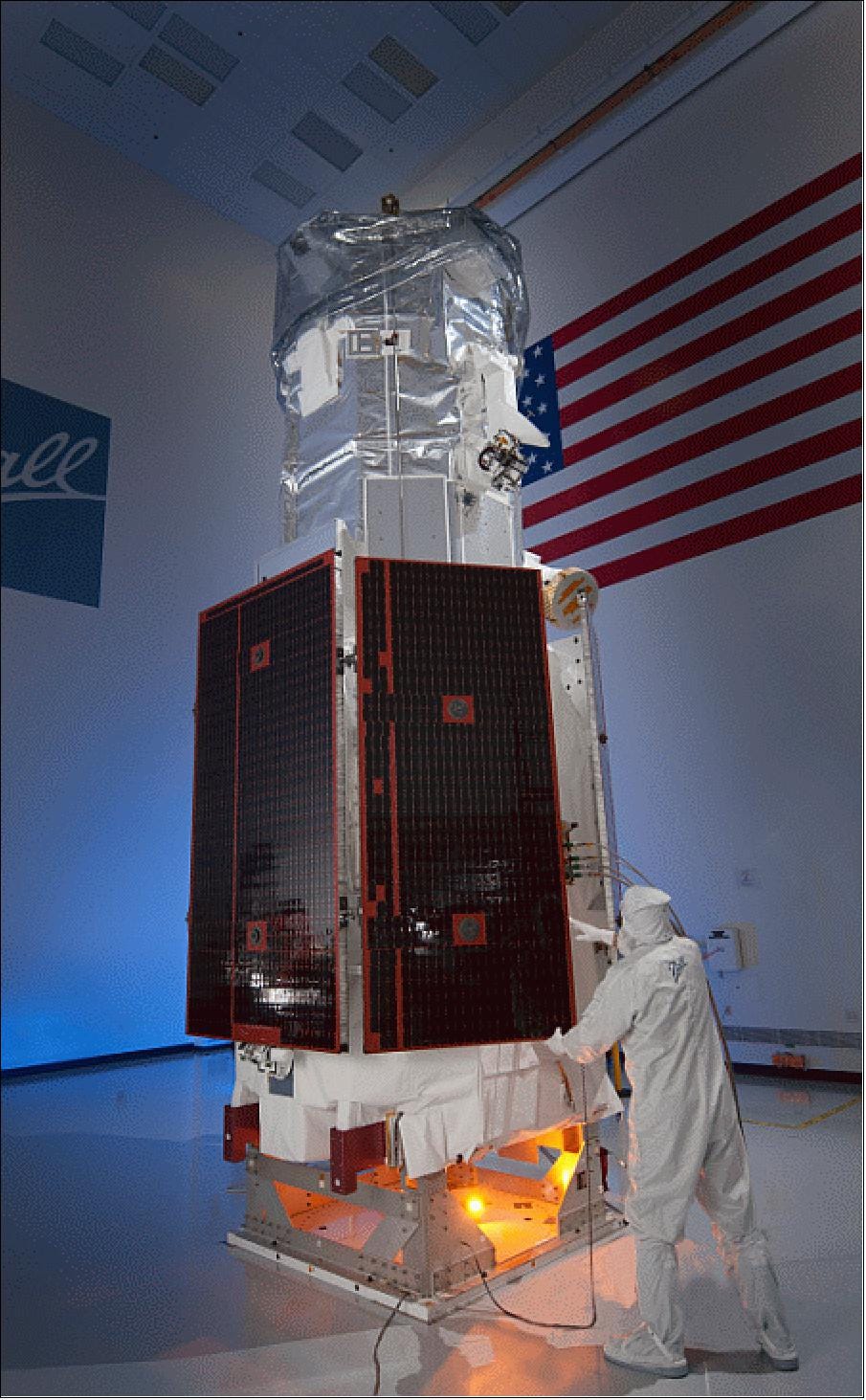
Big satellites translate to big build and launch costs. Worldview-3 cost about $600M to get operational (even before the costs associated with financing those activities). Maxar’s next generation of satellites, “Legion,” will be smaller and cheaper (about one third the size of WorldView-3), but they still anticipate the constellation will cost hundreds of millions of dollars. That’s a lotta cheddah.
Demand
The “medium” resolution persistent surveillance experiment that Planet has been running for the last decade has not paid off (at least, not yet). The central idea is a very compelling one—if you take a picture of the entire landmass of Earth once a day, you don’t have to deal with the opportunity cost that drives tasking-oriented companies to keep the price of satellite imagery so high. A variable cost suddenly becomes fixed, and you can build a different sort of business model—one that’s more like a software business with infinitely small marginal cost to serve each new customer.
But, the imagery is more than ~10x lower resolution than the kind of stuff WorldView-3 produces. And most people don’t want that.
Planet’s acquisition of the high resolution constellation SkySat (née Terra Bella) from Google, and their subsequent decision to drop the orbital altitude in order to achieve ~72cm resolution (vs. 90cm originally), conveys a clear message. I strongly believe that for commercial purposes, it’s super-high-resolution-or-bust.
It suggests a demand curve that is not, shall we say, evenly distributed across spatial resolution:

Here’s a whole tweet storm on the topic about it if you want go dig deeper:

The punchline: optical imagery providers today don’t support monitoring use cases for anything short of a military budget.
Enter: Umbra
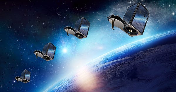
Umbra has designed and manufactured a very interesting type of satellite that leverages a technology called Synthetic Aperture Radar (SAR) to measure the Earth. Earlier this year, I wrote at length about why this genre of Earth observation is so exciting compared to optical imagery, and if you’ve never heard of SAR, it’s probably worth checking out that article since I’m not going to go in depth here. To crudely summarize:
SAR renders “images” of Earth by beaming down radar pulses and measuring the response. This technique images the Earth equally well during day or night. SAR can also “see” through clouds. As a result, every image a SAR system captures of the Earth is relatively unobscured, and which gives SAR constellations much greater freedom to maneuver around the globe for efficient tasking vs. their optical counterparts.
Unlike optical imagery, SAR doesn’t require a large lens to resolve images. Rather, it uses an antenna, which can be folded up during launch. That means you can squeeze higher resolution from a smaller package, which in turn means you can manufacture and launch these satellites relatively inexpensively.
There’s also a technique called interferometric SAR (InSAR for short) that can measure extremely subtle changes in elevation over time based on the phase shift of the radar return. You know how police sometimes use radar guns to tell how fast you’re going? That’s a depth finding application for radar. InSAR works like a depth finder, allowing analysts to precisely measure which parts of the world are getting closer or further from the satellite (“uplift” vs. “subsidence”). If you build a house, the roof is closer to space than the foundation was when you started, which shows up as uplift. If an aquifer drains, an entire valley might literally sink a few centimeters, which shows up as subsidence. It’s a nifty feature of SAR that is very difficult to replicate with optical imagery and allows for relatively straightforward change detection (called “coherent change detection” when specifically describing InSAR-derived changes).
Umbra is not the first startup to think of commercializing SAR satellites. In fact, they are the underdog (at least on paper):
ICEYE, a Finnish startup, launched their first prototype satellite in January of 2018. They currently have 2 satellites on orbit, with 16 more planned. They’ve raised over $150M, with $87M of that coming just a few months ago in a Series C financing.
Nipping at their heels is Capella Space, an American startup which just launched their first operational satellite in August of last year. They plan to build a 30-satellite constellation over the coming years and have raised over $80M from top-tier investors (and I would not be surprised if a Series C or some alternative financing is imminent now that they’re streaming data down).
Earlier this year, PredaSAR announced that they raised $25M in seed funding (what do these designations mean anymore?) and swiftly packed their leadership team with retired military generals in a bid to position themselves as an up-and-coming defense contractor. I love the name—it’s very…earnest.
Betting on the Underdog
If you search around for Umbra, you won’t find much. Founded in 2015, the company was self-funded for years and kept a low profile as its founders, David Langan and Gabe Domincielo, stayed quietly focused on delivering early versions of what would become their marquee satellite design. They don’t make public declarations about launch dates, or how many satellites they plan to launch, or really much at all in the way of forward-looking statements. I like that. A lot.
They have a lot to be proud of, despite opting not to call much attention to themselves. The technology they’ve built is ridiculously impressive. Weighing in at about ~65kg, you could probably check an Umbra satellite on an international flight. Yet, despite the small size, the forthcoming constellation of satellites, once on orbit, will be able to capture images of the Earth at resolutions below 25cm GSD.
There are two important innovations that set them apart from the competition:
Umbra will be able to capture insanely high resolution images using a remarkably tiny satellite. They’ll use a proprietary radar that allows for greater bandwidth, resulting in images rendered at a higher spatial resolution. Specifically: their radar generates a signal greater than 1,200MHz of bandwidth (as opposed to ~300MHz for ICEYE and ~500MHz for Capella despite those satellites being significantly heavier).
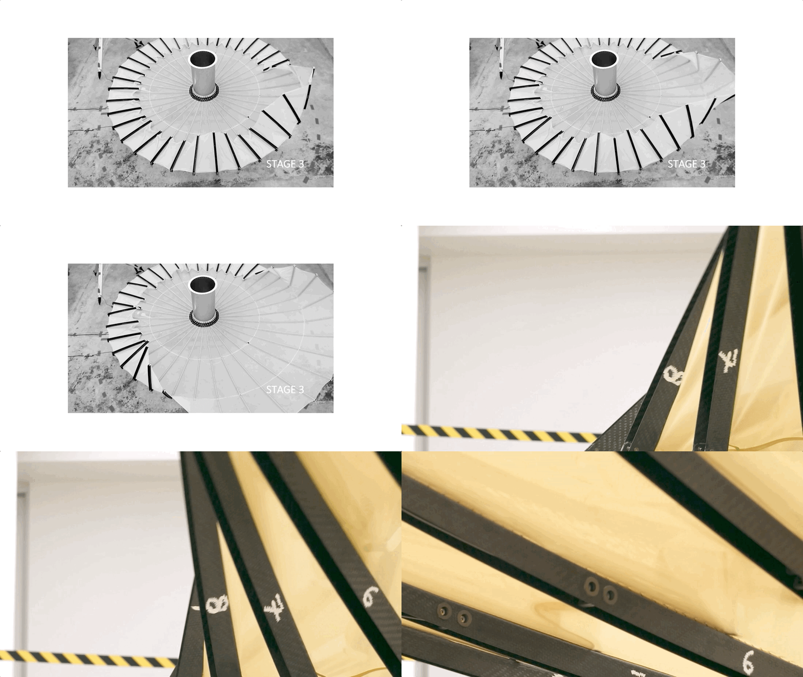
Their other big innovation is described in their publicly issued patent. It has to do with the antenna design itself—not only does the >10m² surface fold up into an extremely tiny package, but it’s also designed with a shock-absorbing rib/mesh combination that dampens interference caused by the satellite’s in-orbit maneuvering (resulting in a higher average throughput of images per day per satellite, since less time is wasted waiting for the antenna to stop vibrating).
A Nascent Market
I consider myself a fairly competitive person. I want to crush the competition. But I’m not referring to Capella or ICEYE—in fact, I deeply admire both of those organizations. I hope they’ll be closer to allies than foes, because SAR is not a “winner-take-all” market anymore than sneaker manufacturing is.
The “competition” in SAR’s case is a massive, untapped market of people who have no idea they would benefit from SAR and would find this blog post even more tedious than you do. As with most “innovative” technology, the biggest competition is the status quo:
Every bank that sends staff to construction sites once a year instead of checking on progress remotely once a week;
Every zoning and tax office waiting for people to call in with tips about unsanctioned building activity instead of monitoring for change proactively;
Every counter-party to a contract guaranteeing land will remain undeveloped and hoping for honest self-reporting;
Every aid and relief organization trying to understand the situation on the ground during a major flooding event with no access to real-time satellite imagery due to clouds;
Every journalist working to expose human rights violations on land they’re disallowed from visiting;
Et cetera
The broader technological trend Umbra is but a small participant in is the inevitable digitization of everything. Marc Andreessen’s opus magnum Why Software is Eating the World came out when I was a freshman in college, although I wasn’t paying attention at the time. In the years since, I’ve heard a similar sentiment echoed countless times—perhaps my favorite articulation of the idea is from an interview with Michael Mayer, founder of an automated coffee subscription business called Bottomless Coffee:
Anytime you can make something important legible to computers, you can change the world. If you look at all of the revolutions that happened after smartphones got significant penetration, it was because suddenly people's locations were legible, and the world around them was legible with cameras.
I’m about to get highfalutin, so bear with me. I believe the most urgent gap in human knowledge at the moment is a high fidelity, global, timely understanding of land use and land cover change. As I wrote earlier this year, I am grateful to work in an industry with a unique role to play in the coming climate crisis:
Understanding and managing land is where I believe geospatial technology will play its most highly leveraged role over the coming decades. We’ve been cataloging the Earth’s contents in increasingly fine-grained detail for millennia — now we’re going to be forced to make dramatic choices about its composition over the next decade or face entirely avoidable and horrifying consequences.
I don’t care about putting satellites in space because it sounds cool. I care about it because it’s the only way I know of, logistically, to gather the information necessary to make informed decisions about land use on a truly global scale.
Risks
There’s a lot that can go wrong. Understanding the key risks of any endeavor, and being able to articulate how you’re mitigating them, is part of the fun of working at startups. Here are some I’ve thought a lot about:
Technical
I don’t know how to build satellites. I’m now going to work for a satellite imagery company. I have no more understanding of how SAR satellites are manufactured than I do of how artificial neural networks work—I’ve seen the output firsthand, and I’ve read about the design, but I still couldn’t personally make one with an unlimited amount of time.
When trying to understand Umbra’s technical risk, I called a few people who knew the industry inside-and-out and were willing to talk to me off the record. They all said the same thing: Umbra has a spectacularly talented and experienced hardware team, and there’s a genuine innovation at the core of their work. That was enough for me.
Regulatory
The largest US-based satellite imagery provider, Maxar, first asked the U.S. Commerce Department for permission to image the Earth at 25cm resolution in 1999 (back then they were called EarthWatch Incorporated). They finally granted permission in 2014. That’s the kind of regulatory uncertainty that can suffocate a startup.
Space-borne satellite imagery is subject to regulation from a laundry list of agencies because of the sensitivity of the data:
NOAA officially regulates commercial Earth observation through the Commercial Remote Sensing Regulatory Affairs (CRSRA) office.
The rockets used to get satellites to space are licensed by the Federal Aviation Administration (FAA) as are the commercial launches themselves via the Office of Commercial Space Transportation (which is, for reasons beyond me, abbreviated AST).
In order to send information down from space, you need to have radio frequency (RF) allocated for your communications, which is regulated by the Federal Communications Commission (FCC).
And even once you’ve navigated the gauntlet of the first two agencies, because you are trafficking data that can be used for military purposes, you are subject to International Traffic in Arms Regulations (ITAR), which is enforced by The Directorate of Defense Trade Controls (DDTC) under the U.S. Department of State.
But wait! There’s more! The U.S. Department of Commerce has authority to regulate foreign exports of satellite imagery, usually acting through the Bureau of Industry and Security. This authority is directly spelled out in the original Land Remote Sensing Policy Act of 1992 that created the possibility for an industry to exist in the first place.
That’s a lot of red tape!
Successful commercial Earth observation companies coming out of the EU, China, Russia, Japan, India, and elsewhere are suddenly making commercial Earth observation much more competitive. And the DoD is not about to start relying on foreign-based companies for sensitive military intelligence. So, in part because of strategic national security interests, and in part because of pressure from U.S. politicians who understand the U.S. is trending toward losing its edge in commercial space technology, I feel that we’re more likely to see U.S. regulators motivated to work with American remote sensing firms rather than against them. But…who knows?
Financial
While preparing for this job, I interviewed a dozen or so people in leadership positions at commercial satellite imagery companies (past and present). The number one theme from those discussions: Earth imagery is, historically, a low-margin business that costs a lot to get into. Many high-profile companies in the past have gone bankrupt or been forced to sell, and almost every firm with staying power has at some point flirted with insolvency.
Umbra isn’t very public about its fundraising compared to it’s rivals, and it’s true that they have not raised as much money as their higher-profile competitors (although, Umbra did quietly file with the SEC for their recent $32M in new funding). I don’t mind this. In fact, I like it. I believe Umbra has charted a path to profitability by creating an incredibly efficient system. A single Umbra satellite will be able to collect more high resolution data than anyone else on a per-unit basis, meaning lower capex (and more margin). In the end, it all comes down to unit economics, and Umbra will have the best in the business.
Umbra has resisted the temptation of building big sales and analytics teams before even launching a satellite, which not only reduces their overhead but also allows them to partner with great analytics firms without the messy conflict of interest other satellite providers have to navigate.
Profitability equates to indestructibility. And historically, in this industry, the spoils go to the last company standing, not the one that raises the most money or does the most press.
Market/Demand
Have I mentioned that I don’t personally believe there is any significant commercial market for SAR yet? I would bet that civilians spend more on decorative cheese board sets than they do on SAR imagery at the moment.
However, the defense market is fairly mature—the U.S. military has been consistently using this technology since the 50’s! The data is nothing new to them, even if procuring imagery from commercial vendors is. Therefore, the short-term success or failure of every single U.S. SAR startup, in my opinion, will hinge entirely on their attractiveness to the U.S. DoD.
If, in the next 3-5 years, a solid foundation of DoD revenue does not materialize, I think the domestic SAR market is likely to collapse under the weight of its own astronomical expectations. If it does materialize, however, I think there’s room for at least a few companies to prosper. Among those, the companies who have the conviction and patience to continually invest in growing the commercial market will be the big winners over the next decade.
In 10 years, the commercial SAR market will either be billions of dollars annually, or it will still be vanishingly small. I doubt we’ll wind up in the middle.
I’m betting my career on the emergence of a massive commercial market. And I believe very strongly that Umbra is the best positioned company in the market to ride that wave.
Ethical
I asked on Twitter recently if anyone knew of a good researcher studying the ethics of civilian Earth observation. I mostly got crickets…
The power to task a satellite (almost) anywhere on Earth and capture a super-high-resolution image comes with an enormous responsibility. There are so many nefarious uses for the data, it’s not even worth listing them out. The obvious implication is that if anyone is allowed to task the imagery that can afford it, then some will use it to surveil others for illegal or immoral purposes (e.g. if you can see when someone is or isn’t home by whether or not their car is parked outside, you can use that information to stalk, burgle, attack, or extort them).
While the privacy concerns associated with high resolution imagery are often overstated, occasionally to a ludicrous degree, the underlying threat of weaponized surveillance is a serious one.
I believe, perhaps naively, that information wants to be free. I believe that Umbra will make access to information about the world freer than it is today, and I believe that’s a worthy mission to dedicate one’s life to. I hope to directly influence the open data and charitable giving policies the company plans to enact, and I cannot wait to see the countless, inventive uses for SAR imagery to come out of the next few years to the benefit of humanity.
If you know of resources on the subject of privacy, surveillance, and ethics, I would welcome any help researching the topic. So far, I’ve found a lot of material on the internet and mobile phones, but not much on Earth observation.
Having My Cake and Eating It, Too
There’s one other detail I neglected to mention. Joining me from Azavea will be Chris Brown and Matt Williams, two of the most talented people I’ve ever worked with. Chris was the lead software engineer on my team at Azavea, and Matt was the lead designer at the company. The three of us will have a chance to help Umbra build the best data distribution platform in the industry, and I can’t wait for the challenge.
Life is short, and in years like 2020 it can feel all the shorter. I am grateful that through luck and happenstance I will have a chance to continue working with two people I love, admire, and trust deeply. But, I also look forward to making some new friends at Umbra—hopefully ones that, like Matt and Chris, I would be content to keep working with for the rest of my career.
To a new chapter, a new year, and a new dental insurance provider. Ad astra!




So good to hear, Joe! Love the thought that went into this decision. I have a colleague that joined Capella Space last year. Having also touched the optical imagery space, SAR is almost certainly the most viable of the bunch. Best wishes on your next adventure!
All the best on your new journey and keep writing! I want to know more about SAR in energy and planning applications. Whose work do you suggest I follow?